Skip to content
+33 608370249
info@alpha-omegaonline.fr
Crète, Grèce
DECOUVERTE
Carte de Grèce
Carte d’Athènes
Carte de Rhodes
Carte de Corfou
Carte de Kos
Carte de Santorin
Carte de Mykonos
Carte de Zakynthos
Carte de Lesbos
Carte de Crète
Carte de Chania
Carte de Rethymnon
Carte de Héraklion
Carte de Agios Nikolaos
Crète, Top 10
Loutro
Elafonisi
Falasarna
Balos
Chania (Hania)
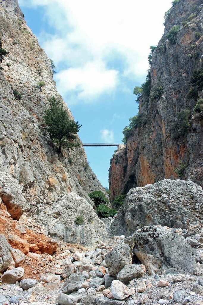
Gorges de Samaria
Rethymnon
Knossos
Agios Nikolaos, Crète
Vai Zakros Palekastro
Infos pratiques
Infos voyage
Quand s’y rendre
Vols et ferries
A voir, à visiter
Hôtels et restaurants
Culture et traditions
Galerie de photos
Belles plages
VOITURES
Crète
Héraklion
Chania
Rethymnon
Agios Nikolaos
Athènes
Corfou
Rhodes
Mykonos
Santorin
Thessalonique
Autres
HÔTELS
BLOG
Villes de Crète
Chania
Rethymnon
Héraklion
Agios Nikolaos
Randonnées en Crète
Gorges de Samaria
Balos, Gramvousa
Gorges d’Aradena
Gorges d’Agia Irini
Visiter la Crète
Akrotiri
Aptera
Frangokastello, Preveli
Arkadi, Anogia
Festos, Gortyne, Matala
Knossos
Crète-mythologie
Histoire de Crète
La presse grecque
La météo en Crète
Contact
Toggle website search
Rechercher sur ce site
Menu
Fermer
Rechercher sur ce site
Crète, Grèce
DECOUVERTE
Carte de Grèce
Carte d’Athènes
Carte de Rhodes
Carte de Corfou
Carte de Kos
Carte de Santorin
Carte de Mykonos
Carte de Zakynthos
Carte de Lesbos
Carte de Crète
Carte de Chania
Carte de Rethymnon
Carte de Héraklion
Carte de Agios Nikolaos
Crète, Top 10
Loutro
Elafonisi
Falasarna
Balos
Chania (Hania)
Gorges de Samaria
Rethymnon
Knossos
Agios Nikolaos, Crète
Vai Zakros Palekastro
Infos pratiques
Infos voyage
Quand s’y rendre
Vols et ferries
A voir, à visiter
Hôtels et restaurants
Culture et traditions
Galerie de photos
Belles plages
VOITURES
Crète
Héraklion
Chania
Rethymnon
Agios Nikolaos
Athènes
Corfou
Rhodes
Mykonos
Santorin
Thessalonique
Autres
HÔTELS
BLOG
Villes de Crète
Chania
Rethymnon
Héraklion
Agios Nikolaos
Randonnées en Crète
Gorges de Samaria
Balos, Gramvousa
Gorges d’Aradena
Gorges d’Agia Irini
Visiter la Crète
Akrotiri
Aptera
Frangokastello, Preveli
Arkadi, Anogia
Festos, Gortyne, Matala
Knossos
Crète-mythologie
Histoire de Crète
La presse grecque
La météo en Crète
Contact
Toggle website search
La Crète et la Grèce
Tout un rêve!
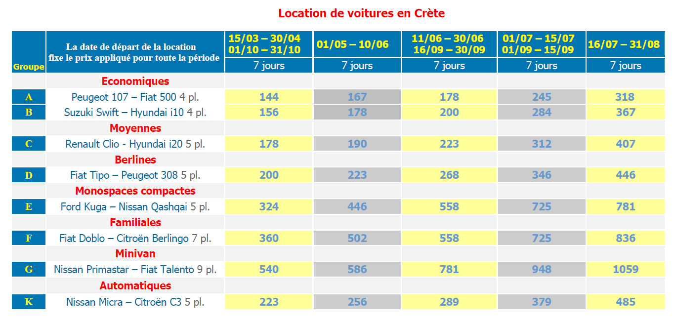
Louez une voiture, et parcourez le pays
Καλημέρα !
Bonjour !
Welcome !
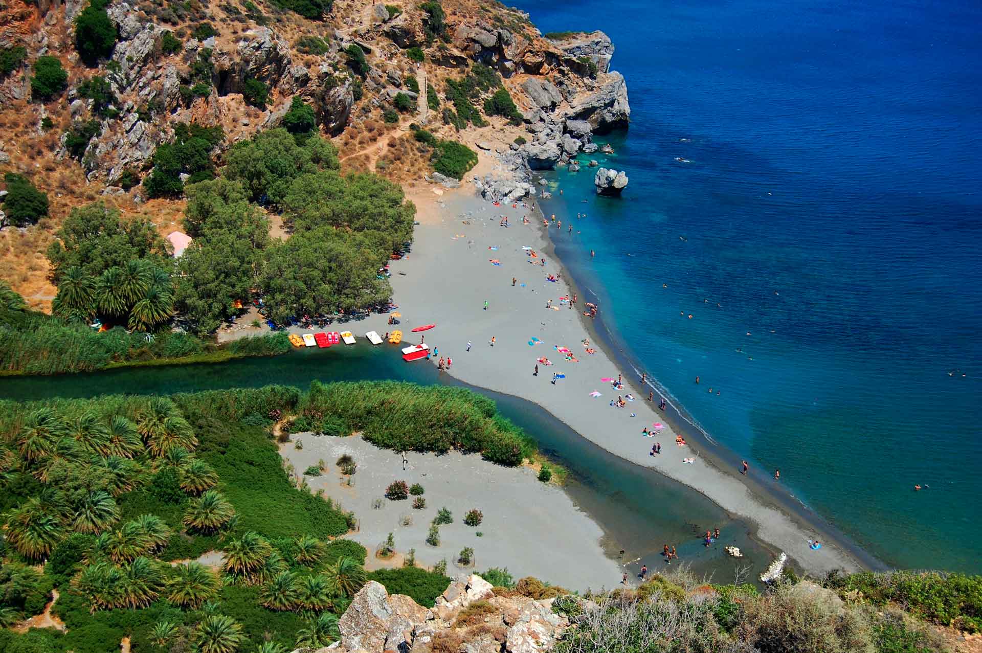
Plage de Preveli, sud de Rethymnon, en Crète